
Airservices says the recently activated Ground Based Augmentation System (GBAS) at Melbourne Airport will reduce flight disruptions and improve airport capacity.
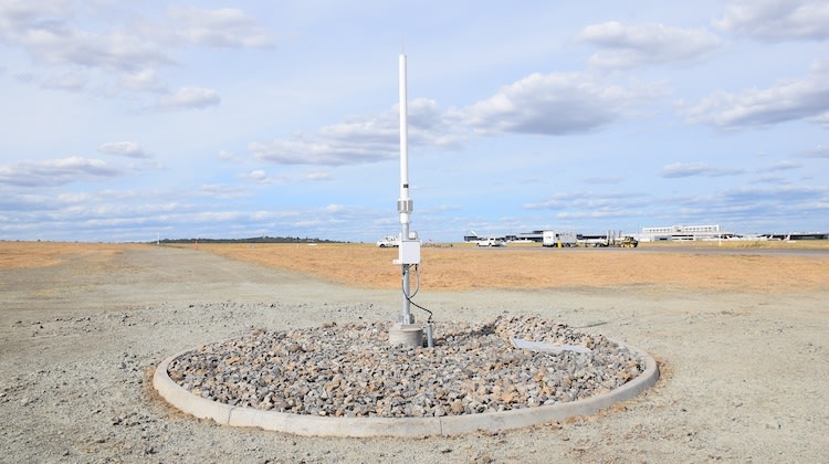
Melbourne Airport has become the second airport in Australia – and indeed in the southern hemisphere – to feature GBAS, a satellite-based precision approach and landing system that allows aircraft equipped with the necessary technology to land in low visibility conditions.
This content is available exclusively to Australian Aviation members.
A monthly membership is only $5.99 or save with our annual plans.
- Australian Aviation quarterly print & digital magazines
- Access to In Focus reports every month on our website
- Unlimited access to all Australian Aviation digital content
- Access to the Australian Aviation app
- Australian Aviation quarterly print & digital magazines
- Access to In Focus reports every month on our website
- Access to our Behind the Lens photo galleries and other exclusive content
- Daily news updates via our email bulletin
Airservices said its ‘SmartPath’ GBAS system, first installed in Sydney in 2014, provides precision approaches by broadcasting error-corrected GPS positioning data to a suitably-equipped aircraft’s flight management system via a radio datalink from a ground-based transmitter.
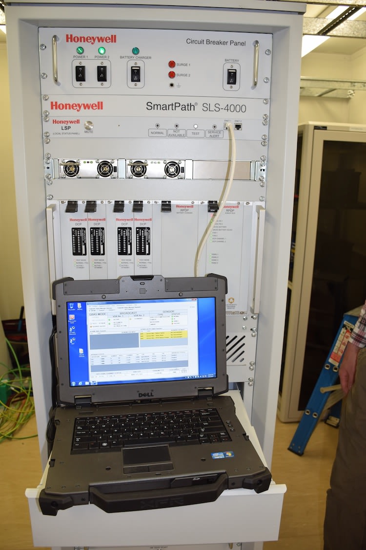
Further, the Honeywell SLS-4000 GBAS SmartPath was capable of providing up to 26 simultaneous instrument approaches within a 42km radius from the airport and promised to reduce maintenance and provide more efficient calibration than traditional instrument landing systems.
Melbourne Airport chief of aviation Simon Gandy welcomed use of more effective and reliable forms of aircraft navigation utilising satellite-based technology.
“GBAS can provide a more resilient system for all runway approaches at Melbourne Airport, providing airlines and air travellers an enhanced level of service particularly when the airport is experiencing poor weather conditions,” Gandy said.
Airservices said the benefits of GBAS at other locations included “more efficient descent and landings as well as less flight disruptions and improved airport capacity from accurately guided, simultaneous operations”.
“The integration of SmartPath both at Sydney and Melbourne Airports highlights Airservices commitment to embracing Global Navigational Satellite Systems (GNSS) technology which deliver higher performance services to our customers,” Airservices executive general manager for air navigation services Stephen Angus said in a statement.

Airservices said it would keep working with the airline industry to “encourage increased rates of installation of SmartPath-capable avionics”.
According to Honeywell, compared with ILS GBAS required only a single installation per airport (rather than at each runway end), was less expensive to maintain, and was not susceptible to noise signal interference. GBAS approaches could also be designed “to avoid terrain, shorten track miles, and reduce noise and emissions while improving traffic throughput”.
Airservices published a video explaining how GBAS works on its YouTube channel in September 2016.
Want to see more stories from trusted news sources?
Make Australian Aviation a preferred news source on Google.
Click here to add Australian Aviation as a preferred news source.


Geoff
says:PER, ADL, BNE next applications? When?
Yusef Danet
says:Shame they didn’t install it halfway down the Princes Highway, then it could cover Avalon, Tulla and Essendon. Avalon is outside the 23nm radius. Just.