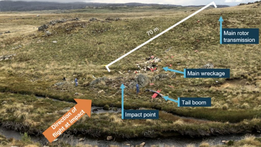
A helicopter that crashed with two people onboard in Kosciuszko National Park in April descended quickly while navigating terrain amid poor weather conditions, the ATSB has found.
On 3 April, a privately-owned Bell LongRanger helicopter was travelling from Majura, NSW to Mangalore, Victoria, via Tumut, when it crashed at Kiandra Flats in the NSW Snowy Mountains with two occupants onboard.
Emergency services located the crash site just after midnight, about nine hours after the crash. Both occupants had been fatally injured in the crash.
Inspection of the crash site and helicopter showed no evidence of a system failure or in-flight break-up.
According to the Australian Transport Safety Bureau, both the aircraft and pilot were operating under visual flight rules at the time, as one helicopter in a group of seven, when the weather began to deteriorate, causing the six other helicopters to land on a property near Wee Jasper.
Meanwhile, the pilot of the accident helicopter continued further south before ultimately landing alongside Long Plain Road in the Brindabella region, and contacting the rest of the group.
Almost three and a half hours after landing beside Long Plain Road, recorded flight tracking data showed the LongRanger took off again at 1453 local time, the report stated.
Local police officers “observed the helicopter depart to the south at low level, in overcast conditions with low cloud and light rain,” ATSB Director Transport Safety Stuart Macleod said.
According to the report, the forecast for the area at the time of this second flight indicated broken cloud between 2,500 ft and 10,000 ft above sea level.
Tracking data, reviewed by the ATSB, showed the helicopter progressed below 500 ft above ground level, following geographical features along lower lying terrain.
“About 10 minutes into this second flight, the pilot turned north-west and took up a track towards Tumut, which they had indicated to the tour group as their intended refuelling destination,” Macleod said.
“They then encountered higher terrain and turned around to head southward, again following lower lying terrain for another 10 minutes, before reaching Anglers Reach, at which point they turned back on a track towards Tumut.”
The helicopter climbed to 7,000 ft above sea level – about 2,500 ft above ground level – and continued for about six minutes, before descending to 6,800 ft, and almost immediately climbing again.
“After climbing to 7,400 ft, the helicopter commenced the steep turn, its ground speed increased to 134 kt, and its descent rate exceeded 3,800 ft per minute.”
The helicopter impacted terrain at 1526 in an area of tussock grass, interspersed by bare protruding rock.
The following morning, in response to the LongRanger not meeting the tour group as planned at Mangalore, Victoria, a search was initiated. Assisted by aircraft tracking data, a ground team located the accident site that evening.
The ATSB’s subsequent examination of the site indicated the helicopter’s engine was providing power at impact, and there was no evidence of an in-flight break-up or a pre-existing defect with the drive train or flight controls.
“As the investigation progresses, the ATSB will further review and analyse pilot and maintenance records, recovered wreckage components, the flight tracking data, witness information and meteorological data,” Macleod said.
A final report will be released at the conclusion of the investigation.


