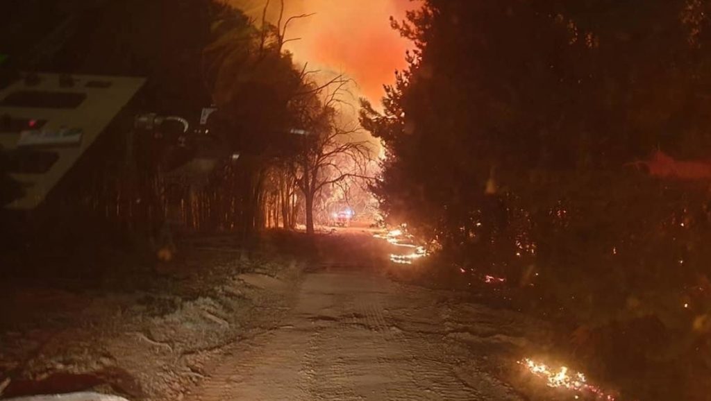
A new aerial system that can map the path and growth of bushfires in real-time will soon begin trials in South Australia.
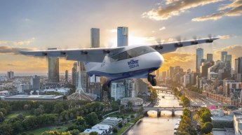
Adelaide-based company FireFlight Technologies has created a system that uses thermal imaging sensors mounted to a manned aircraft, to detect flames through kilometres of thick and billowing smoke, and accurately track a fire’s path.
This crucial information about the blaze can then be delivered to local firefighting efforts within one minute, according to FireFlight founder and CEO Dr Paul Dare.
With support from the University of South Australia’s Innovation and Collaboration Centre, FireFlight has been awarded $100,000 under the state government’s Go2Gov program in order to produce the trial.
The trial will see FireFlight team up with the South Australia Country Fire Service (CFS) to provide real-time fire mapping from above throughout this year’s bushfire season, with the hopes of using such information to limit the destruction of bushfires.
Dare, also a volunteer firefighter, has previously used the FireFlight system to air in the 2019-20 Kangaroo Island bushfires, to provide key information on the blaze to firefighters and defence personnel.
The system has also been used overseas to track wildfires in Montana and California, as well as trials in Queensland and Tasmania, however, the South Australian trial will be the first to see the system implemented throughout the entire bushfire season.
“The FireFlight system will deliver real-time fire intelligence to incident controllers, helping them to efficiently deploy resources such as firefighters, fire trucks and firebombers where they are really needed,” Dr Dare said.
“The fire maps provided by the FireFlight system will show exactly where the fire is at that moment.
“The maps can be updated on a minute-by-minute basis, enabling the CFS to monitor the progression of the fire and better understand its behaviour.”
Dare said that the season-long length of this trial will allow FireFlight to “make changes to the system” as necessary, “based on feedback from the CFS, so that we can ensure we are meeting their needs”.
CFS manager, state air operations, Nik Stanley said the trial will help to further develop the technology.
“The CFS is looking forward to seeing the results of further trials, developments and evaluations of the FireFlight fire mapping technology,” Stanley said.
“The current trial will be fully evaluated at the end of this fire danger season by our Fire Behavioural Analysis team within the CFS and our partner agencies.”
Meanwhile, Minister for Innovation and Skills David Pisoni said this grant under the Go2Gov program is “another example of a project that pushes the boundaries and provides a solution to an important problem”.
“As South Australia faces another potentially dangerous bushfire season, this trial will help the CFS identify how a bushfire is moving so they can best allocate their resources to fight it,” Pisoni said.
UniSA’s Innovation & Collaboration Centre director, Jasmine Vreugdenburg, said FireFlight Technologies was leading the way in crucial disaster management innovation.
“It’s crucial that Australia becomes a leader in this space as climate change continues to have a devastating impact across the globe,” Vreugdenburg said.
“FireFlight stands as a testimony to what can be achieved when we provide innovators and startups with the support and financial backing they need – it can change the world for good.”
The news comes after a former deputy fire commissioner of NSW said “not much seems to have been done” a year to the day since the Bushfires Royal Commission report was published.
“We don’t think much has changed since the fires of 2019-20,” said Jim Smith. “We don’t feel any safer than we did before.”
The technically titled Royal Commission into National Natural Disaster Arrangements released its final report 12 months ago. Its most significant recommendation was the call for a new “sovereign aerial firefighting capability” that can be easily shared between areas in need.
However, no such fleet has yet to be formed, with the federal government’s formal response being that it simply “notes” the recommendation.
Smith, a former Deputy Commissioner of Fire and Rescue NSW, was speaking in his capacity as a member of Emergency Leaders for Climate Action (ELCA), a campaign group composed of 33 former fire and emergency service chiefs.
“Many people are living in fear of the next fire,” said Smith. “Without emissions reductions this decade, it’s just going to keep getting worse. At the very least, every recommendation of the Royal Commission should be implemented.”


peter
says:Air Affairs based at Albatross airfield industrial park near Nowra NSW has been developing and using just this sort of technology for years. They are doing this NOW, yet in November 2019 still did not know if they would have any contracts to continue work over the peak fire season 2019/20, not research, actually fire mapping and reporting.
Australia should be a world leader in this technology and capability and IS, though what we are capable of NOW is being suppressed, actively restricted. Go figure.
Combining efforts rather than simply re-inventing the wheel is the only way. Dividing efforts into competitive separate groups is part of the stifling of invention and productive efforts. Those who will do harm must be put aside as a danger to us all. Joint efforts accelerate positive outcomes.
Mike Sibley
says:Did not Mr Smith really mean hazard reduction but is tongue tied to “emission reduction”?