New Zealand’s commercial market for drones is booming, largely thanks to a collaborative approach by its Civil Aviation Authority.
Its Part 101 consultation rules and Part 102 unmanned aircraft certification has resulted in 108 unmanned aerial vehicles (UAVs) receiving certification in the past few years.
More than 400 commercial UAV users are registered on the website of their national body, UAVNZ.
UAVNZ chair Andy Grant said if a commercial operator is able to demonstrate a safe way of bringing a drone business to market then the CAA is very open to discussing and accommodating new developments.
As the market for commercial applications opens up in a wide number of fields, be it agriculture, mining, search and rescue, urban planning or anywhere where an unmanned vehicle can go where it is risky for manned vehicles and where it makes economic sense, New Zealand’s commercial operators are jumping in.
a wide number of fields, be it agriculture, mining, search and rescue, urban planning or anywhere where an unmanned vehicle can go where it is risky for manned vehicles and where it makes economic sense, New Zealand’s commercial operators are jumping in.
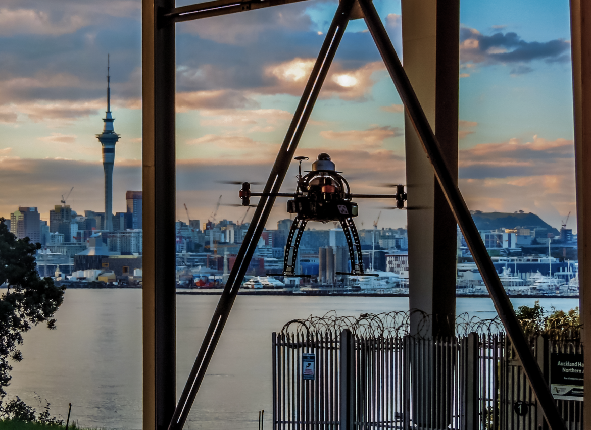
Now the focus is on technology and applications for flying beyond the line‑of‑sight (BLOS).
A report commissioned by Callaghan Innovation, a government organisation tasked with making New Zealand business more innovative, estimated last year that flying drones out of the operator’s line of sight could provide economic gains of up to NZ$190 million annually to the country’s farming, forestry and energy sectors.
Last year Taranaki drone company Drone Technologies controlled remotely an unmanned aircraft in New Zealand’s first “beyond line‑of‑sight” CAA‑approved flight to inspect a 30km section of power transmission lines in the Rimutaka Ranges near Wellington for electricity utility, Transpower.
Managing director Ben Plummer said the flight demonstrated the importance of beyond line‑of‑sight in industry and agriculture, in risky conditions, delivering parcels and medical supplies to remote locations or communities in crisis.
For the trial the drone had the same procedures, safety checks and planning as a manned flight, including a flightplan, getting permission to operate in that airspace at that time, and intensive training for the pilots for the 54-minute flight.
More tests are in the pipeline. The country’s air traffic controller, Airways New Zealand, Graeme Sumner said that New Zealand’s regulatory environment and relatively uncongested airspace made the country an attractive option to safely support more complex operations and facilitate new entrants.
It has developed a nationwide unmanned aerial vehicle (UAV) traffic management system which would enable drone activity across New Zealand airspace through a safe integration into the national air traffic network. Some South Island drone pilots are putting its AirMap drone traffic management platform through trials that involve how to plan flights, seek authorisations and get information about the terrain they are operating in.
The next phase is tracking tools that enable accurate monitoring of drones once they are beyond the pilot’s line‑of‑sight and detect and avoidance capabilities to keep them safely separated from other aircraft.
Australian Aviation talked with three innovators in the New Zealand UAV commercial space.
University of Canterbury (Christchurch)
Canterbury University’s Wireless Research Centre and Spacial Engineering Research Centre are attracting interest from universities around the world wanting to collaborate on drone projects.
A strong drawcard is its 100sq km CAA-designated restricted UAV testing range with a ceiling of 1,000 metres at Birdlings Flat, 30km from the city. There, post-graduate students test everything from sensing systems to algorithms that autonomously evaluate the suitability of a landing site prior to a safe landing, to radio frequency. They have tested positioning technology to determine precise positioning during landing and takeoff and a UAV platform that autonomously records a forest’s “cutover” geographic edge for accurate tree harvesting.
Japanese collaboration
The Royal Society of New Zealand and The Japanese Society for the Promotion of Science jointly gave NZ$60,000 recently to a collaborative project by the university’s Wireless Research Centre and Japan’s Yokohama National University to develop a device that enables multiple drones to communicate with each other while flying over a natural disaster area. The task was to collect information about the status of people buried under rubble so they could potentially be triaged for rescue.
The fxuturistic technology revolves around body area Wi‑Fi networks where interconnected devices are implanted, attached or carried by a person, be it a mobile phone, exercise wristband or in the fabric of a garment. The research focused on ways those network signals could be located by a swarm of drones so first responders on the ground could find survivors quickly.
Fred Samandari, director of the university centres, said the drones picked up signals even if connections were damaged, to indicate whether a person was dead or alive. It adds another layer to drones kitted with thermal heat imaging for detecting people at a distance in search and rescue operations.
The device was tested in non-emergency situations in the first phase of the project.
Now the universities are seeking an additional NZ$200,000 to bring the project to market.
Canterbury’s students have also been researching ways UAVs can withstand elements and air pressure when collecting samples such as water or volcanic ash in hard to reach places and returning with them in one piece.
“We needed to make sure the samples collected were secure and that they didn’t end up splashing all over the place,” Samandari said.
Forests
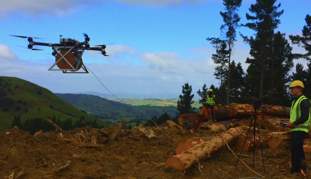
The centres designed a drone to monitor hotspots in bushfire situations for the government’s forestry research institute, Scion.
Scion has been at the forefront of publicly and privately funded trials of UAVs flying beyond the line of sight for the evaluation of tree harvesting and relaying tree health and pests in forests using interchangeable remote-sensing technology.
“We’re definitely aiming for a future beyond visual line of sight,” Samadari said.
“Here in NZ aviation authorities are extremely open. They really want to liberate the industry.
“At present when trees are cut the contractor gets paid after a certain period of time based on an estimate, but owners want a clear understanding of where the cut was. “drones can see deterministically where trees are cleared and what is still standing.”
Partnering with Lincoln Agritech, a research and development subsidiary of Christchurch’s Lincoln University, the university has also used drones to determine the health of crops, using three or four drones that automatically start recharging after returning from their mission.
Also with Lincoln, it has developed special antennae for UAV fixed-wing and quad and opti helicopters to withstand the harsh environment of Antarctica. The drones fly over the sea where piloted helicopters can’t go to measure ice shelves.
“They need just enough protection but enough time to fly before the propellers start freezing,” Samandari said.
“You want to make sure payload is as little as possible down there, but if something unexpected happens you need features that will always bring the UAV’s back because nothing can be left behind. You can’t tether as that is limiting so we have a separate operator with another UAV taking measurements from different angles and monitoring the other.”
The university has also worked with meteorological companies such as New Zealand’s National Institute of Water and Atmospheric Research (NIWA) on drones that can rise more than 10,000 metres above the ground for weather monitoring.
They’re attached with “intelligent” balloons to bring craft back safely.
Other projects include work with Airbus at its Blenheim base and with Zephyr Airworks, the New Zealand arm of Californian-based Kittyhawk, presently trialling Cora, a self-piloting electric air taxi for a global launch from New Zealand in a few years’ time. Confidentiality agreements preclude Samandari revealing details, but he said it is “exciting”.
Nearly all students are post-graduates ranging in numbers each year from 12 to 40 plus two to three overseas interns. As a research centre it doesn’t do qualifying courses such as drone pilots.
Skybase.aero
Christchurch-based Skybase.aero is not yet a year old but its business delivering commercial drone solutions with real-time awareness is growing exponentially. Its new testing range will also take its technology beyond the line-of-sight.
Co-founder, Michael Read, a former RAAF pilot, moved to New Zealand three years ago to work at jetpack start-up Martin Aircraft Company before setting up Skybase. The other co-founder, San Francisco-based Alex Flemming, an aviation, defence and security stalwart, procures the technology for Skybase’s platforms.
Read is not long back from signing a surveillance contract in South-East Asia. Details are still under wraps, but he said it would require rapid scaling of the business. He’s prepared, thanks to a partnership as well as investment money from US-based MAG Aero, an established company largely in the defence arena. MAG has more than 900 experts across five continents doing intelligence, surveillance and reconnaissance (ISR) real time operations, training and technical services for manned and unmanned fixed and rotary-wing operations.
Skybase is focused on commercial opportunities, but Read said the relationship has enabled it to deliver military-level services at a fraction of the cost of the big military providers.
The data links and long-endurance/long-range ability assembled on drones raised the overall capability of a client’s businesses, he said.
“We can access these capabilities by virtue of the team’s background in military, manned aviation and unmanned technology and the integration of world-leading assets to meet and exceed technical and market challenges.”
Flying beyond the line-of-sight is the next area of significant growth in the commercial drone market and Read said Skybase is ready.
Test zone
Like Canterbury it has created a CAA-restricted drone test zone for BLOS trials near Alexandra in Central Otago, chosen because of its high number of sunny days and low winds.
Read said it required a large amount of work with the CAA, but said it would have been impossible to get it up as quickly as it did elsewhere in the world.
“We’re starting to attract a lot of international attention from companies wanting BLOS applications for their commercial drones,” he said.
“New Zealand is a first-world country that is highly respected around the world. Operators can come here to test our data link and fully instrumented test range year round.”
Skybase is also one of the companies about to start trials with the country’s air navigation service provider, Airways NZ, to show how it can be interoperable with its system.
Read said being a data provider is about a mesh network – the ability to send information to platforms with multiple pathways without any loss of bandwidth.
“You can’t have people talk about delivering a payload and using BLOS unless you have a high-quality network. We literally have the world’s best airborne mesh network with up to 100 MB of data.
“We have a CAA Part 100‑compliant safety management system, a full set of operating procedures, arguably the most advanced regularity system in the Asia Pacific region; we all come from aviation backgrounds and we have our own compliant test facilities.
Skybase data is also fully encrypted in-house, eliminating the risk of exposure by outside contractors.
The revenue stream from airborne data comes from aerial mapping to surveillance in sectors from mining to road projects, stockpiles, land design, urban planning, working with fire and environmental agencies and tactical operations with the police.
Doing good
Another focus is the global “Drones for Good” humanitarian work. Skybase will work with UNICEF in Vanuatu in September delivering vaccines using high band connectivity either through a radio frequency, satellite, 4G or a relay node.
“With our powerful network we can be sitting on a laptop in Christchurch controlling one of our drones in South-East Asia in real time and we can also log into the picture of the drone on a mobile phone. In a tactical situation you can have real-time pictures without interfering with any other network. You can also send voice and video data to anyone with a smart phone who has a VPN login.
“The reason we established business in New Zealand is because of our relationship with the CAA and its forward thinking nature,” Read said.
“It was a stroke of genius for CAA to write the Part 102 regulations as performance-based rules. It requires the industry to prove to the regulator how it is going to keep [their drone operation] safe as opposed to the CAA being prescriptive.
“We can run technology through traditional aviation systems to work out whether it meets the intent of the regulators.”
Skybase is looking for PhD students to work with its staff of 13. Kelvin Barnsdale, Canterbury University’s former senior research engineer in the Spatial Engineering Research Centre is also on board. He specialises in electronic systems in harsh environments.
“Kiwis go really well in the innovation space doing more with less, but often need help to scale overseas,” Read said.
Any future funding would be to do with scaling, but it was revenue that grew the business.”
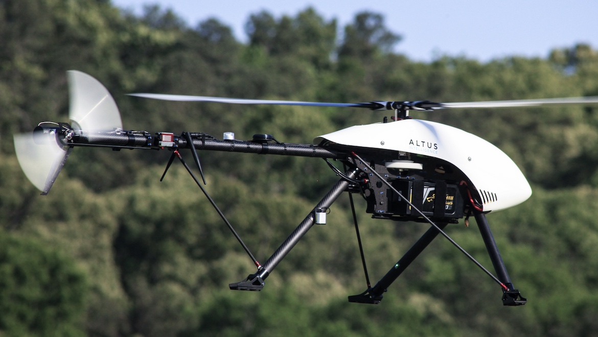
Altus Intelligence
The drone hardware manufacturer with its unique gas-fired parachute and beyond the line-of-sight capabilities was founded in 2014 by Shaun Mitchell (chief executive) Simon Morris, Ryan Cadwallader, Michael Long and Gareth Prentice. Altus has grown rapidly from its Hamilton headquarters. Last year it opened its Altus Made in the USA office in Cartersville, north of Atlanta in the United States, bringing the total number of staff to nine.
It was initially a service provider, adapting drones for specific needs, primarily in the mapping and survey field as well as some aerial photography and cinematography. After finding a shortage of commercial grade, rugged and reliable sensor-friendly equipment for clients’ specific needs Altus started manufacturing its own unmanned aircraft. When they found themselves competing on the service side with customers who bought their equipment they decided to concentrate on the hardware.
With China controlling 70 per cent of the world’s UA manufacturing, small companies like Altus can’t compete on price so the point of difference had to be around capability, applications, robustness and support. Business development manager Simon Morris said inspections are the fastest growing commercial application for drones, ranging from powerlines to forests and crops.
This has put the company’s focus firmly on developing beyond the line‑of‑site craft. Altus is the first company in the US to get a FAA waiver for its helicopter drone for powerline inspection for its client, Xcel Energy, a utility company with more than three million electricity customers. The hybrid machine it is developing is presently using a battery with three hours of charge, powered by a small petrol motor.
“Traditionally, powerline inspections are done with helicopter pilots using binoculars. It’s very expensive and they can miss things,” Morris said.
“We’ve done 80km, stringing three of these together but we want to do it with one.
“We’re taking a full size aircraft approach to maintenance and inspection of these craft.
“These are people’s investments and we want to keep them going as long as possible.”
Morris, a former air force pilot who has also done geospatial mapping for the army, says the team had seven years’ experience in the field before forming Altus.
That experience, along with a collaborative relationship with the CAA helped the company get a foothold in the US. It sold one of its Delta X8 drones to US broadcaster CNN for aerial news-gathering then partnered with CNN for 18 months on one of three FAA Pathfinder projects, evaluating unmanned aircraft systems for safety and functionality in the field, particularly loss of line-of-sight control, and ranges up to 200km.
Morris said owning drones commercially in the US was cumbersome because it required every owner of a drone weighing more than 2kg to be registered whereas in New Zealand, an organisation could be certified for drone operations. But with the introduction of the FAA part 107 US commercial drone operators were now leapfrogging countries like New Zealand in the technology stakes, he said. Hence the Altus US division.
“When we hit the ground in the US they were amazed how much experience we had. We are really good at finding new applications,” he said.
“Customers tell us what the application is and we’ll put it on the best vehicle, building up from a base platform. Each wants something slightly different and we can do that in-house.”
When the New Zealand Police came knocking that opened the door to a new development – a gas-propelled parachute.
“They wanted a craft that could safely reconstruct the scene after road accidents, and for search and rescue,” Morris said.
If anything went wrong with the craft they wanted it to be able to land safely without damaging people or the craft itself.
“When you have $200,000 of laser scanners hanging up in there, mitigating harm gets you preferential rates from insurers.”
Developing a chute with a tiny cylinder of compressed carbon dioxide instead of explosive detonators was the groundbreaker. It activates quickly after the failure of two autopilots catches the weight of the drone. Apart from the insurance advantage it can be transported safely on manned aircraft and eliminates the risk of fire on the ground.
The project was initially shelved because it was not viable to keep craft at Altus until the police needed them. But now Altus is on the shortlist in a new tender round after the police decided they need their own drones after all.
Altus was created on the back of NZ$1 million raised through the team’s own funds, support from a Northland surveyor, and from friends and family.
It’s now on the lookout for a venture capitalist to fund the next development – an IP licence in the US where the marketplace is the most active. Manufacturing and the research and development will remain in New Zealand.
“We have to be flexible and fast moving and to do that we need to bring new products,’ Morris said.
He said the Australian market was largely untapped for the company but it was talking to large enterprises across the Tasman with the intent of forming a partnership instead of growing the market itself.
This feature article first appeared in the July 2018 edition of Australian Aviation.
To read more stories like this, subscribe here. Digital editions of the magazine can be purchased on Zinio and Issuu, or in the Apple app store.