

Drone operators have been warned to stay away from Illawarra Airport during Sunday’s delivery flight of Qantas’s Boeing 747-400 VH-OJA.
The Civil Aviation Safety Authority (CASA) has declared an eight nautical mile circle around Illawarra Airport as temporary restricted airspace between 0730 and 0830 Sunday, the expected arrival time of the aircraft.
CASA has also designated a straight section out to the east over the ocean from central Wollongong – the expected path of arrival – as temporary restricted airspace.
“It will create unoccupied airspace for the last stage of the flight of the Qantas 747-400 City of Canberra into the Illawarra Airport,” CASA said in a statement on Wednesday.
“The temporary restricted airspace is in place from the ground up to 4,500 feet above mean sea level.
“People in the Illawarra with drones must not fly in the temporary restricted airspace.”
CASA said it would have inspectors at the airport on Sunday to “monitor the safety of the 747 operation”.
The regulator noted drones were prohibited from operating within 5.5km of an airport at any time.

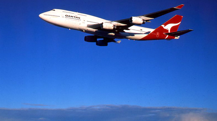
Qantas is gifting the aircraft, which flew non-stop from London to Sydney as part of its delivery flight in 1989 and was the Flying Kangaroo’s first 747-400, to the Historical Aviation Restoration Society, where it will be placed on public display.
The jumbo will fly from Sydney Airport to Wollongong on Sunday morning and Shellharbour City Council said the airport would be closed from 0600, with Tongarra Road, Illawarra Highway and north bound Princes Highway, Albion Park Rail closed for about 10 minutes before landing.
The council said the aircraft could be seen at places around Illawarra such as near the athletics grounds and BMX track at the Croom Sports Complex, given it was being flown at low altitude overland from Wollongong to West Dapto, south over Yallah and Haywards Bay.


William
says:It might be a bit hard to police given you can operate a drone with just a mobile phone or tablet. Hopefully common sense prevails and people heed the warning or OJA has enough fuel for a go around!
Martin
says:Can or has this flight path been published on Google earth or is the .kmz file available?